Gravel Grinding
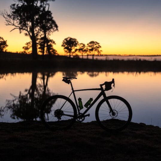
Our friends from twowheeltours and goodnessgravel have designed and reviewed 6 courses from around Glen Innes Highlands perfect for your very own self-paced rides.
Each course varies in difficulty and has full or short options to suit different experience levels.
1. Fun of Furracabad Loop (55km or 42km loop)
2. Beauty of Bald Nob Loop (96km)
3. Beardy/Red Range/Pinkett/Pretty Valley (90km or 56km)
4. Black/Slow/Mitchell/Nightcap Mountains (130km or 80km)
5. The Kings Loop/Kingsland and Kings Plains (113km or 64km)
6. The Big Loop (170km or 87km)


Fun of Furracabad Loop - Short
(Short - 42km)
Difficulty Level: 2/5 (2 - 3 hours).
Level of Rider: Beginners / Family / Open for all riders but you should have experience riding on gravel and this should not be the first time you ever complete such a distance.
NOTE: there is a fast descent on this loop. All riders must know how to descend and use their brakes to come to a safe stop.
Suggested Bikes: Gravel, E-Gravel, Flat Bar, MTB or E-MTB possible. Not suitable for road bikes.
Surface: A mix of gravel and paved roads. Note that the conditions of all the roads can change due to weather conditions such as rain and long dry periods.
Other: At the end of the ride, when you turn RIGHT onto the Gwydir Highway, riders have ~2.5km along this section before the speed limit changes to 50kph. There is a decent shoulder and the terrain is relatively flat.
Min Elevation: 1,048m
Max Elevation: 1,199m
Estimated ride time @ 15kph: ~2:48 hours
Estimated ride time @ 25kph: ~1:41 hours

Fun of Furracabad Loop (Long)
(Long - 55km)
Difficulty Level: 2/5 (2 - 4 hours)
Level of Rider: Beginners / Family / Open for all riders but you should have experience riding on gravel and this should not be the first time you ever complete such a distance.
NOTE: there is a fast descent on this loop. All riders must know how to descend and use their brakes to come to a safe stop.
Suggested Bikes: Gravel, E-Gravel, Flat Bar, MTB or E-MTB possible. Not suitable for road bikes.
Surface: A mix of gravel and paved roads. Note that the conditions of all the roads can change due to weather conditions such as rain and long dry periods.
Other: At the end of the ride, when you turn RIGHT onto the Gwydir Highway, riders have ~2.5km along this section before the speed limit changes to 50kph. There is a decent shoulder and the terrain is relatively flat.
Min Elevation: 1,048m
Max Elevation: 1,311m
Estimated ride time @ 15kph: ~3:40 hours
Estimated ride time @ 25kph: ~2:12 hours

Beauty of Bald Nob Loop
(96km)
Difficulty Level: 3/5 (4 - 6 hours).
Level of Rider: Intermediate and above. Riders should have experience riding on gravel and this should not be the first time you ever complete such a distance.
Suggested Bikes: Gravel, E-Gravel, Flat Bar, MTB or E-MTB possible. Not suitable for road bikes.
Surface: A mix of gravel and paved roads. Note that the conditions of all the roads can change due to weather conditions such as rain and long dry periods.
Other: There are two different sections when you will be riding on the Gwydir Highway. The first is a RIGHT turn, across traffic, for 1.2km. The second is a LEFT on to the Gwydir Hwy for 1km. Then you then turn RIGHT back onto a quiet gravel road. Use extreme caution along these sections.
Always ride to your abilities.
Min Elevation: 1,002m
Max Elevation: 1,168m
Estimated ride time @ 15kph: ~6:24 hours
Estimated ride time @ 25kph: ~3:50 hours

Beardy /Red Range /Pinkett / Pretty Valley (Short)
(Short - 56km)
Difficulty Level: 2/5 (2 - 3 hours).
Level of Rider: Beginners / Family / Open for all riders but you should have experience riding on gravel and this should not be the first time you ever complete such a distance.
Suggested Bikes: Gravel, E-Gravel, Flat Bar, MTB or E-MTB possible. Not suitable for road bikes.
Surface: A mix of gravel and paved roads. Note that the conditions of all the roads can change due to weather conditions such as rain and long dry periods.
Other: With the section of Pinkett Road being an out and back, there is a large hill to descend and also ascend in each direction. This loop requires plenty of endurance and is not for the faint hearted because of the hilly terrain.
Always ride to your abilities.
Min Elevation: 1,032m
Max Elevation: 1,201m
Estimated ride time @ 15kph: ~3:44 hours
Estimated ride time @ 25kph: ~2:14 hours

Beardy /Red Range /Pinkett / Pretty Valley (Long)
(Long - 90km)
Difficulty Level: 3/5 (3 - 6 hours).
Level of Rider: Intermediate and above. Riders should have experience riding on gravel and this should not be the first time you ever complete such a distance.
Suggested Bikes: Gravel, E-Gravel, Flat Bar, MTB or E-MTB possible. Not suitable for road bikes.
Surface: A mix of gravel and paved roads. Note that the conditions of all the roads can change due to weather conditions such as rain and long dry periods.
Other: With the section of Pinkett Road being an out and back, there is a large hill to descend and also ascend in each direction. This loop requires plenty of endurance and is not for the faint hearted because of the hilly terrain.
Always ride to your abilities.
Min Elevation: 1,032m
Max Elevation: 1,206m
Estimated ride time @ 15kph: ~6:00 hours
Estimated ride time @ 25kph: ~3:36 hours

Black /Slow /Mitchell / Nightcap Mountains (Short)
(Short - 80km)
Difficulty Level: 3.5/5 (3 - 5 hours).
Level of Rider: Intermediate and above. Riders should have experience riding on gravel and this should not be the first time you ever complete such a distance.
Suggested Bikes: Gravel, E-Gravel, Flat Bar, MTB or E-MTB possible. Not suitable for road bikes.
Surface: A mix of gravel and paved roads. Note that the conditions of all the roads can change due to weather conditions such as rain and long dry periods.
Other: There are some fast descents along this course, requiring plenty of endurance and not for the faint hearted because of the hilly terrain.
Always ride to your abilities.
Min Elevation: 1,036m
Max Elevation: 1,275m
Estimated ride time @ 15kph: ~5:20 hours
Estimated ride time @ 25kph: ~3:12 hours

Black /Slow /Mitchell / Nightcap Mountains (Long)
(Long - 130km)
Difficulty Level: 4.5/5 (5 - 9 hours).
Level of Rider: Advanced. Riders should have experience riding on gravel and this should not be the first time you ever complete such a distance.
Suggested Bikes: Gravel, E-Gravel, Flat Bar, MTB or E-MTB possible. Not suitable for road bikes.
Surface: A mix of gravel and paved roads. Note that the conditions of all the roads can change due to weather conditions such as rain and long dry periods.
Other: There are some fast descents along this course. This loop, even the SHORT loop, requires plenty of endurance and is not for the faint hearted because of the hilly terrain.
Always ride to your abilities.
Min Elevation: 971m
Max Elevation: 1,323m
Estimated ride time @ 15kph: ~8:40 hours
Estimated ride time @ 25kph: ~5:12 hours

The Kings Loop /Kingsland and Kings Plains (Short)
(Short - 64km)
Difficulty Level: 2.5/5 (2 - 4 hours).
Level of Rider: Beginner and above. Riders should have experience riding on gravel and this should not be the first time you ever complete such a distance.
Suggested Bikes: Gravel, E-Gravel, Flat Bar, MTB or E-MTB possible. Not suitable for road bikes.
Surface: A mix of gravel and paved roads. Note that the conditions of all the roads can change due to weather conditions such as rain and long dry periods.
Other: Watch/enjoy the wind during this loop, there is a reason why there are windmills along this loop. The earlier your start time, the less the wind should play a factor.
Always ride to your abilities.
Min Elevation: 744m
Max Elevation: 1,014m
Estimated ride time @ 15kph: ~4:16 hours
Estimated ride time @ 25kph: ~2:33 hours

The Kings Loop /Kingsland and Kings Plains (Long)
(Long - 113km)
Difficulty Level: 4/5 (4 - 7 hours).
Level of Rider: Intermediate and above. Riders should have experience riding on gravel and this should not be the first time you ever complete such a distance.
Suggested Bikes: Gravel, E-Gravel, Flat Bar, MTB or E-MTB possible. Not suitable for road bikes.
Surface: A mix of gravel and paved roads. Note that the conditions of all the roads can change due to weather conditions such as rain and long dry periods.
Other: Watch/enjoy the wind during this loop, there is a reason why there are windmills along this loop. The earlier your start time, the less the wind should play a factor.
Always ride to your abilities.
Min Elevation: 744m
Max Elevation: 1,076m
Estimated ride time @ 15kph: ~7:32 hours
Estimated ride time @ 25kph: ~4:31 hours

The Big Loop (Short)
(Short - 87km)
Difficulty Level: 4/5 (3 - 5 hours).
Level of Rider: Intermediate and above. Riders should have experience riding on gravel and this should not be the first time you ever complete such a distance.
Suggested Bikes: Gravel, E-Gravel, Flat Bar, MTB or E-MTB possible. Not suitable for road bikes.
Surface: A mix of gravel and paved roads. Note that the conditions of all the roads can change due to weather conditions such as rain and long dry periods.
Other: There are some steep long climbs along this course. This loop, even the SHORT loop, requires plenty of endurance and is not for the faint hearted because of the hilly terrain.
Always ride to your abilities.
Min Elevation: 768m
Max Elevation: 1,119
Estimated ride time @ 15kph: ~5:48 hours
Estimated ride time @ 25kph: ~3:28 hours

The Big Loop (Long)
(Long - 170km)
Difficulty Level: 5/5 (7 - 11 hours).
Level of Rider: Advanced. Riders you should have experience riding on gravel and this should not be the first time you ever complete such a distance.
Suggested Bikes: Gravel, E-Gravel, Flat Bar, MTB or E-MTB possible. Not suitable for road bikes.
Surface: A mix of gravel and paved roads. Note that the conditions of all the roads can change due to weather conditions such as rain and long dry periods.
Other: There are some steep long climbs along this course. This loop, even the SHORT loop, requires plenty of endurance and is not for the faint hearted because of the hilly terrain.
Always ride to your abilities.
Min Elevation: 737m
Max Elevation: 1,119
Estimated ride time @ 15kph: ~11:20 hours
Estimated ride time @ 25kph: ~6:48 hours

Relaxing Ride Around Town
Refresh and unwind as you ride around town. Take in the beautifully manicured parklands running adjacent to Glen Innes' historic main street, Grey Street. Pull up at one of our buzzing cafe's or eateries, there's plenty to choose from.
Centennial Parklands, home of the Australian Standing Stones National Celtic Monument is also a must see, along with Martin's lookout just up the hill from the stones.

Before you go...
Please take care when exploring our region by bike. Your own cycling safety is a responsibility that you must prioritise, including riding within your own ability level. Follow this helpful safety checklist to help ensure your ride safe and enjoyable:
- Follow the road rules at all times.
- Check your bike and equipment before you depart (i.e. tyre and brake conditions, lubed chain, helmet condition, etc.). Make sure it is all in good working order and if in doubt take it to a bike shop before you venture out.
- Always tell someone where you are going and your estimated time of return.
- Check the weather forecast for the area where you will be riding.
- Carry maps and/or a well-charged GPS device for the area you are riding in.
- Phone coverage is not always available but a well-charged phone should be carried in case of an SOS emergency.
- Always carry enough water, food and sunscreen, especially when riding for long periods of time and in remote areas.
- It is highly recommended that you do not ride alone in remote areas.
- Always be aware that road conditions and access regularly change due to weather conditions (e.g. heavy rainfall and severe dry conditions). Check the weather forecast and local road conditions before venturing out.
Glen Innes: Gravel Fondo Events
This annual event hosted by goodnessgravel brings riders together to explore exciting locations in Glen Innes Highlands.
Not for the faint-hearted, the rides are designed for experienced riders with distances starting at 35km up to 125km.


Mountain Biking
For mountain bikers, the Gibraltar Range and Washpool World Heritage National Parks offer 80km of scenic trails.
Road & Rail Trail Riding
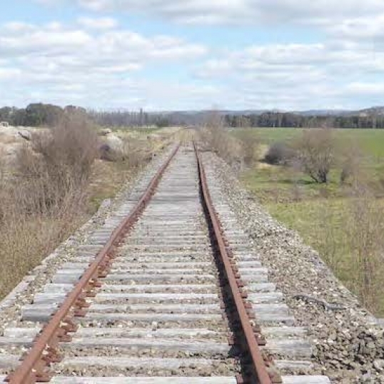
Stay tuned! An exciting new experience is in development bringing life back to the disused railway corridor between Glen Innes and Ben Lomond, giving the community and visitors access to untapped picturesque parts of our scenic countryside.
-
Partner with us
- Add your business
- Use of GIH logo
-
Related Sites
- Glen Innes Severn Council
- Glen Innes Highlands Hub
Acknowledgement of Country
Glen Innes Highlands acknowledges and pays respect to the Ngarabul people as the traditional custodians of this land, their elders past, present and emerging, and to Torres Strait Islander people and all First Nations people.
Terms & Conditions | Privacy | Disclaimer
2025 © All Rights Reserved. Website designed by gocrossmedia and built by Cloud Concepts


